790
FXUS65 KTWC 242020
AFDTWC
Area Forecast Discussion
National Weather Service Tucson AZ
120 PM MST Fri Jul 24 2026
.SYNOPSIS...
Isolated thunderstorms through this evening will bring a slight
chance of a severe wind gust threat. High temperatures will be 8
to 12 degrees above normal through Saturday, with an Extreme
Heat Warning in effect through early Saturday evening.
Increasing coverage of thunderstorms is expected Saturday going
forward into next week.
&&
.DISCUSSION...
The upper level ridge sits just to the east centered over
southern New Mexico today, a location that has a limiting
influence on thunderstorm coverage for southeastern Arizona.
While the synoptic setup isn`t ideal for monsoon activity, there
remains adequate lower level moisture characterized by 55-60
degree surface dew points and intense surface heating,
increasing MLCAPE values to 500-1000 J/kg. To add another
ingredient to the mix, wind speeds in the mid-levels are notable
for this setup and will produce around 20-25 kts of effective
shear. The combination of these factors will provide a severe
wind threat with any thunderstorm that sustains itself today,
though the coverage is again less certain and likely more
isolated given the nearby ridge. 12Z ensemble guidance
highlights the somewhat more likely risk of a severe wind gust
in areas south and west of Tucson, mainly from a Tucson-Nogales
line west to Sells. But any location will have a small but non-
zero risk.
The upper ridge will lift north slightly and become more
centered over the Four Corners on Saturday, putting southeastern
Arizona in a more favorable location for more widespread
thunderstorm activity. Moisture will be on the rise with
precipitable water values increasing to 1.2-1.6 inches and mid-
level flow will remain around 15-20 kts, providing an
instability/shear parameter space for a severe wind gust threat.
Thunderstorms should initially form over the Sky Islands and
White Mountains during the first half of the afternoon,
increasing in coverage and moving into the lower desert
locations in the late afternoon and the evening from central
Pima eastward. Westward expansion will depend on outflow
collisions but adequate low level moisture and mid-level support
exist that convection should move into western Pima in the late
evening, though likely with less severity with the loss of
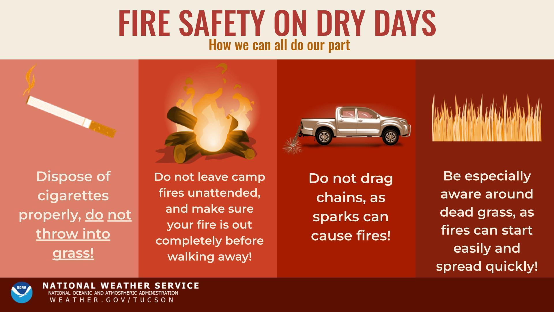
daytime heating. Blowing dust and flooding will also be threats
with any thunderstorm, though the flash flooding threat will be
on the lower side as storm movement should preclude widespread
problematic rainfall totals.
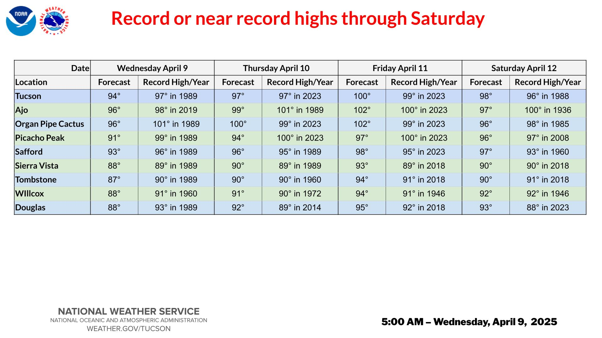
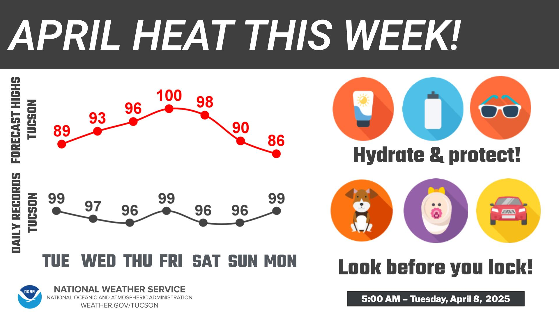
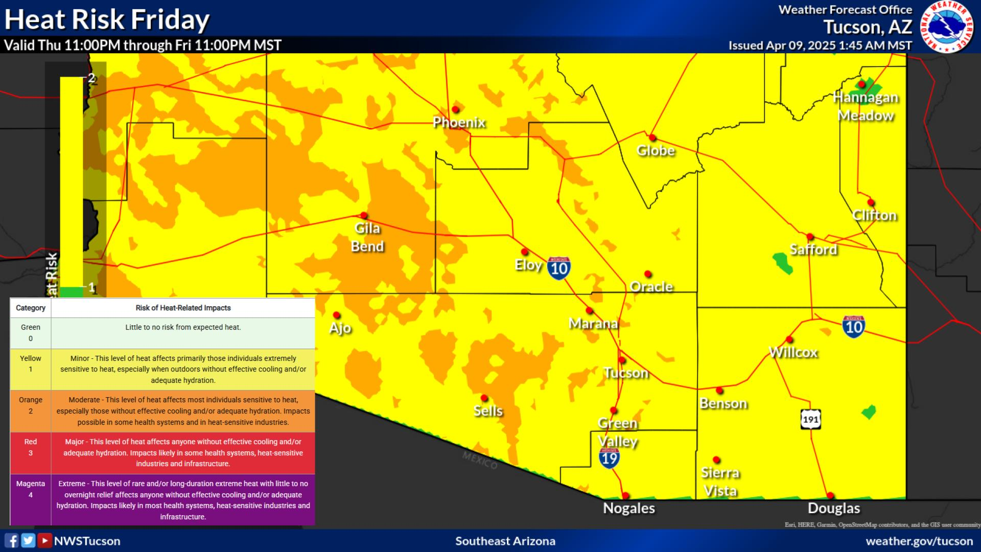
Above normal high temperatures remain a hazard today and
Saturday with highs 8 to 12 degrees above normal. Additionally,
morning lows will be quite warm, especially from Tucson west
where Saturday morning lows will remain above 82 degrees. An
Extreme Heat Warning remains in effect until Saturday evening.
The upper level high remains in a similar location Sunday
through at least the first half of next week, providing daily
chances for thunderstorm activity. Temperatures by Monday should
fall back to around normal, though an increase is possible by
the end of the work week as the upper high center moves more
over Arizona.
&&
.AVIATION...Valid through 25/00Z.
FEW-SCT clouds with 8k-12k ft ceilings this afternoon and
evening with isolated TSRA, especially north of KSAD and near,
south, and west of KTUS-KOLS. Any thunderstorm may produce
strong and erratic wind gusts, with a slight chance of a severe
wind gust. Otherwise surface winds northwest 5-10 kts, becoming
light and terrain driven after 25/03Z. Thunderstorm chances
return and become more widespread across southeastern Arizona
Saturday afternoon and evening. Aviation discussion not updated for TAF
amendments.
&&
.FIRE WEATHER...
Strong high pressure aloft will bring high temperatures up to 8
to 12 degrees above normal through Saturday. Isolated
thunderstorm activity will linger this evening, then more
widespread chances are expected Saturday afternoon and evening.
Thunderstorms should form over the Sky Islands and White
Mountains in the first half of the afternoon, spreading into
desert locations westward through central Pima county in the
late afternoon and early evening, moving into western Pima in
the late evening. Any thunderstorm will bring a threat of
severe, erratic wind gusts as well as brief heavy rainfall and
an isolated threat of flash flooding. Deeper moisture will move
into the region this weekend and continue daily thunderstorm
chances into much of next week. Minimum relative humidity values
will increase from 15-20 percent in desert location and 30-40
percent in the mountains on Saturday to above 20-40 percent
Sunday through mid-week next week. Winds this weekend will
mainly be light and under 12 mph outside of thunderstorms.
&&
.TWC WATCHES/WARNINGS/ADVISORIES...
Extreme Heat Warning until 8 PM MST Saturday for AZZ501>509.
&&
$$
DISCUSSION...Edwards
AVIATION...Edwards
FIRE WEATHER...Edwards
Visit us on Facebook, X, YouTube, and at weather.gov/Tucson
NWS Tucson (TWC) Office