345
FXUS65 KPSR 251121
AFDPSR

Area Forecast Discussion
National Weather Service Phoenix AZ
421 AM MST Sat Apr 25 2026

.UPDATE...Updated 12Z Aviation Discussion.

&&

.KEY MESSAGES...

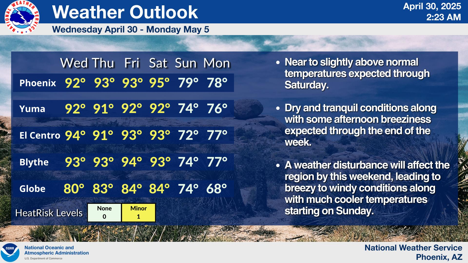
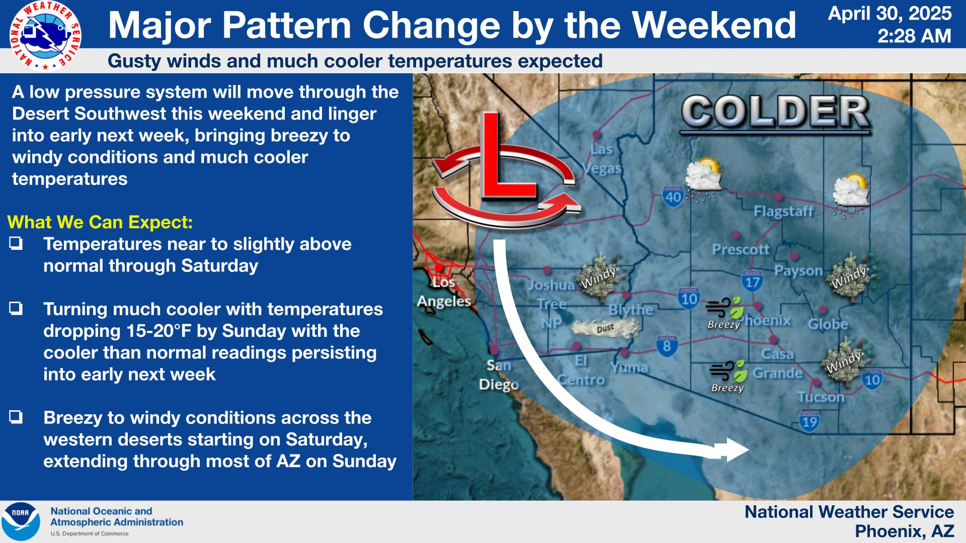
- A mostly dry weather system moving through the region this
  weekend will bring breezy to windy conditions, near to below
  normal temperatures, and a few showers over higher terrain
  areas.

- Temperatures will warm early next week rising to slightly above
  normal starting midweek. Hotter temperatures with lower desert
  highs well into the nineties look possible by next weekend.

- A potential weather system late next week may bring chances for
  showers to the area, but widespread rainfall is not
  anticipated.

&&

.SHORT TERM /TODAY THROUGH SUNDAY/...
Zonal westerly flow continues across the southern CONUS, while a
large upper level trough encompasses the entire Northwest and
North-central U.S. Weak troughing also continues off the
California coast with a developing shortwave trough centered
500-600 miles west of Los Angeles. This disturbance is being
driven by a southern stream upper level jet which is also
advecting in a good deal of upper level moisture and clouds into
our region. Expect fairly thick high level clouds this morning
before thinning from west to east during the afternoon as more
sunshine peaks through the clouds. The clouds will help to keep
daytime highs down from yesterday`s upper 80s/lower 90s with
readings in the low to mid 80s. A tight gradient today should
also result in fairly widespread breezy conditions, but the lack
of strong mixing due to the cloud cover may keep the 20-30 mph
potential gusts more intermittent.

As the disturbance moves onshore into southern California this
evening, even stronger westerly winds will develop across the
area, especially affecting southeast California where Advisory
level winds are likely across Imperial County. Much of the system
energy is expected to move into northern Arizona tonight with at
least a slight chance of some light showers across the high
terrain north of the Phoenix area. For the lower deserts, the lack
of good forcing, limited mid-level moisture, and a dry boundary
layer should at most result in localized trace amounts. A modest
cool front will also move through tonight and this will help to
keep daytime highs Sunday mostly in the upper 70s under mostly
clear skies.

&&

.LONG TERM /MONDAY THROUGH FRIDAY/...
Once the weekend system exits on Sunday, it will leave behind a
drier air mass which will slowly modify and warm Monday into
Tuesday. Skies will remain clear to mostly clear through Tuesday
with high temperatures warming back into the low 80s Monday and
the upper 80s Tuesday. Model uncertainty is still an issue for
later next week as another Pacific weather system is forecast to
develop well west of southern California early in the week before
moving through or near our region at some point during the latter
half of the week. The latest model guidance does indicate a
slightly later timing of the system, now favored more on Thursday
instead of Wednesday. There is also a good deal of uncertainty
with the strength and the amount of moisture that will be
available, but the potential rain chances definitely look better
than this weekend`s system. The latest NBM/WPC PoPs have risen
across south-central Arizona to 20-30%, while the rest of the
lower deserts are more in a 10-15% range.

Temperatures are still likely to warm above 90 degrees during the
latter half of the week, but the uncertainty with the weather
system is providing a wider range of potential highs for Thursday
and Friday. For now, highs for much of the lower deserts should
top out somewhere in the upper 80s to the lower 90s through Friday
before warming up even more next weekend.

&&

.AVIATION...Updated at 1120Z.

South Central Arizona including KPHX, KIWA, KSDL, and KDVT:
The main aviation concerns through the forecast period will be
another round of gusty W-SW winds this afternoon and evening.
Current E-SE winds will go southerly around 15-16Z before going
westerly/southwesterly early this afternoon. Speeds this morning
will be aob 10 kt. Once winds go W/SW gusts up around 20 kt will
be common through the early evening. After sunset wind gusts
should come to an end, however, speeds will remain elevated
(10-15kt). SCT mid to high clouds will increase in coverage
through this morning, with CIGs lowering to 15-20 kft AGL.

Southeast California/Southwest Arizona including KIPL and KBLH:
Increasingly gusty winds late this afternoon/evening will be the
main aviation weather concern through the forecast period. Winds
will remain westerly at KIPL and favor S-SW at KBLH. Wind gusts in
the mid 20s will continue through the majority of the afternoon at
KIPL. At KBLH, wind speeds will be aob 10 kt through the morning
with gusts in the mid 20s starting around noon. Gusts will
increase at both terminals by late this afternoon/early this
evening and will reach up to 30-35 kts at times, particularly at
KIPL. SCT mid and high cloud decks will persist through Saturday.

&&

.FIRE WEATHER...
An approaching weather system will bring increased winds today,
while lingering through Sunday. Wind gusts will peak late this
afternoon and through the evening, commonly reaching 20-25 mph in
many locations to as high as 35-50 mph across portions of
southeast California. Winds Sunday will peak in the afternoon with
gusts between 20-30 mph. Expect MinRHs this afternoon 15-20%
before increasing further Sunday to 20-30%. Overnight recoveries
will continue to improve, rising to 40-60% tonight before
dropping off again early next week. A mostly dry weather system
passing through the region tonight may bring some high terrain
showers, but CWR is less than 10%. Seasonably breezy afternoon
winds and drying conditions are forecast for early next week, but
winds will fall short of creating widespread elevated fire
weather concerns.

&&

.PSR WATCHES/WARNINGS/ADVISORIES...
AZ...None.
CA...Wind Advisory from 5 PM this afternoon to 5 AM PDT Sunday for
     CAZ560-563>568.

     Wind Advisory until 11 PM PDT Sunday for CAZ562.

&&

$$

SHORT TERM..Kuhlman
LONG TERM...Kuhlman
AVIATION...Berislavich/Salerno
FIRE WEATHER...Kuhlman
NWS Phoenix Office


